|
|
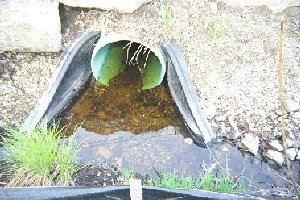
Pipes and culverts needing followup: Small amount of silt in new culvert, FP9
| |
Segment 1: The stream flows between Idylwilde Farm fields, which drain into it (some exemption from the Wetlands Protection Act) and the New View residential development. New View does not seem to fertilize, and maintains buffers. Haybales are still in place. There is much grassy vegetation here.
Segment 2: Bridge crossing Central Street. A silt fence, and murky tealike water were observed.
Segment 3: Douglas School: Trash was present in the wetlands by the stream. How wide is the buffer? Homes on Houghton Lane have backyards virtually in wetlands. Sump pumps were working (where else should water go?). There was backyard litter including leaves and grass clippings.
Segment 4: Gates School Bridge: Loosestrife, trash and litter were observed. The Gates school area has much spongy lawn (this was before the recent rains), with lawn running right down to the stream in some places. There were some obvious erosion points from the lawn into the streams.
Segment 5: Bridge at Arlington Street: The stream flows in a channel to this point. It is quick and perhaps deep. After the bridge it turns into swamp. The pond is on one side. Lawns run to the edge of the pond.
Segment 6: The other side is low wetland rising to a large field, which is privately owned. Is this floodplain? Anemones were present in low areas. There was one garden and a septic system belonging to a new house on Mass. Ave. in the field.
|